Study Area Spotlight
Understanding the Hydrology and Drainage study.
Hydrology and drainage are important processes on Grand Cayman and within the EWA EIA study area. These processes support the health and safety of residents and natural resources.
The project’s study of hydrology and drainage examines the relationship between road construction and surface water run-off movement across the island, considering whether construction of the road would significantly impact natural flow patterns and how to mitigate for those effects.
The EIA also considers what design conditions need to be satisfied to minimize flooding and inundation from the roadway during heavy rainfall and/or severe storm events and potential measures to reduce stormwater runoff pollution during the construction and operation phases of the roadway.

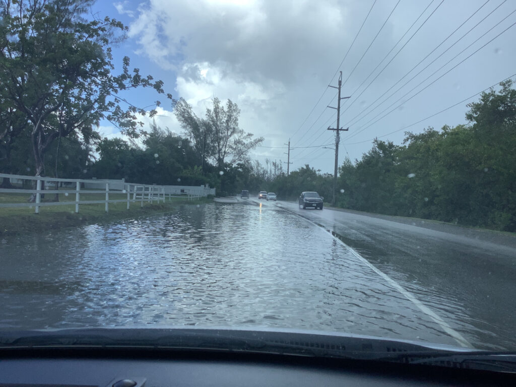
Flooding on Bodden Town Road during July 2023 rainfall event.

Understanding the Socio-Economic study.
A project’s impacts can affect both the natural and human environments. Socio-economic assessments look at the pros and cons a proposed action could have on society.
Socio-economic components such as employment, income, and education affect how humans and communities live.
Assessing the proposed project’s potential to affect changes in these factors aids in providing an understanding of the comprehensive and interrelated needs of individuals and the local communities.
Socio-economic status encompasses both objective characteristics (e.g., income or education) and subjective characteristics (e.g., people’s sense of place).

Assessment and analysis of hydrology and drainage includes the following:
- Analysis of rainfall intensity and extreme weather event identification
- Advanced hydrological and hydraulic modelling for Proof of Concept
- Coastal storm surge and wave overtopping analyses
- “Water budget” analysis for the Central Mangrove Wetland (CMW)
- Groundwater mounding analysis
- Field assessments
Baseline Conditions
Flay, low-lying topography
Tropical climate
Average annual precipitation is around 53 inches
On average, about 150 days of each year receive some rainfall
Tropical thunderstorms, localized weather patterns, and evaporation from the CMW all cause rain during wet season months.
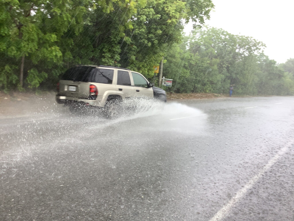
Heavy showers in between long, dry periods can lead to flooding in low-lying areas when the rain does come.
In the dry season, cooler air coming from North America (Nor’Westers) can result in shorter, less frequent precipitation.
Hurricanes are a major climatic factor because the Cayman Islands are located within the Caribbean hurricane belt where hurricanes commonly form. Intense tropical storms and hurricanes are typically accompanied by significant rainfall.
Storm surges combined with wave action are responsible for much of the damage typically caused by hurricanes, especially in large, low-lying coastal settlements.
On average, the Cayman Islands are affected by passing hurricanes every 2+ years and directly hit by hurricanes approximately every 9 years, according to a 2004 study focused on the impacts of Hurricane Ivan in Grand Cayman.
More recently, hurricanes have increased in intensity and rainfall, which may be the result of warming ocean temperatures and more moisture in the air.
There are two main categories of flooding that impact Grand Cayman: coastal and surface runoff.
Coastal flooding has caused much damage in the Cayman Islands with both the intensity of tropical storms and their frequency. Coastal flooding occurs because of the combined increase in water level from storm surge and waves. Due to the overall low elevation of Grand Cayman, coastal flooding extends to large areas of the island even in less severe storms.
Surface runoff flooding typically occurs when a tropical depression settles over the island, depositing extreme amounts of rainfall over several days. Due to the generally low elevation and unconcentrated nature of drainage patterns on the island, there are few surface water flow paths, and surface water flooding is typically slow-moving and widespread.
Another consideration which impacts the effects of storm surge and flooding is the dense vegetation on Grand Cayman which provides flood protection by intercepting and absorbing rainwater before it reaches the ground runoff conditions, holding back water temporarily. The dense vegetation also resists moving water, resulting in a reduction of wave heights and peak flows.
In addition, mangrove roots trap sediments and soil cohesion, is increased by the mangrove root systems, which reduces sediment load in flood waters.
Climate change has already had an observed effect on temperature and weather patterns.
Trends suggest a decrease in total precipitation but an increase in rainfall intensity, which results in more flood and drought events. The change in rainfall patterns, increased evaporation, and extreme weather could impact the hydrology and drainage patterns and the recharging of the island’s freshwater lenses.
Natural resources may influence hydrology and drainage, such as the Central Mangrove Wetland (CMW) and the Mastic Reserve.
The CMW is part of a large-scale water flow system which filters and conditions the surface runoff and shallow ground water that flows into the North Sound while providing a constant flow of nutrients, which form the base of a complex food chain for both terrestrial and marine wildlife. In addition, the CMW plays an important role in the evapotranspiration/precipitation cycle of Grand Cayman, including rainfall generation.
The Mastic Reserve is part of a precipitation/runoff catchment area, absorbing rainfall and gradually releasing it, helping to regulate water flow and is also significant for its role in groundwater recharge.
Regulations for hydrology and drainage are currently being reviewed, including those from the Cayman Islands as well as international standards from the UK, Canada, United States of America (US), and global.
The standards for the US State of Florida are considered specifically because of the geographical proximity to the Cayman Islands and the fact that the state standards cover the regulations for the Florida Keys, which have a similar topography and tropical weather conditions to the Cayman Islands. The determination of applicable governing standards for environmental water quality are being coordinated with the:
- Cayman Island Department of Environment (DoE)
- Water Authority (WAC)
- Department of Environmental Health (DEH)
Based on the results and findings of the studies and field assessments, potential impacts for the proposed roadway project are identified for natural resources, such as the CMW, Mastic Reserve, Meagre Bay Pond, freshwater lenses, as well as developed areas. Methods to avoid, reduce, and mitigate for the impacts are assessed.
The study of hydrology and drainage is a crucial aspect to ensuring the EWA provides a resilient route between east and west on Grand Cayman. Natural and human processes affect how water moves on Grand Cayman. An in-depth understanding of this water movement is an essential part of the EIA.
